
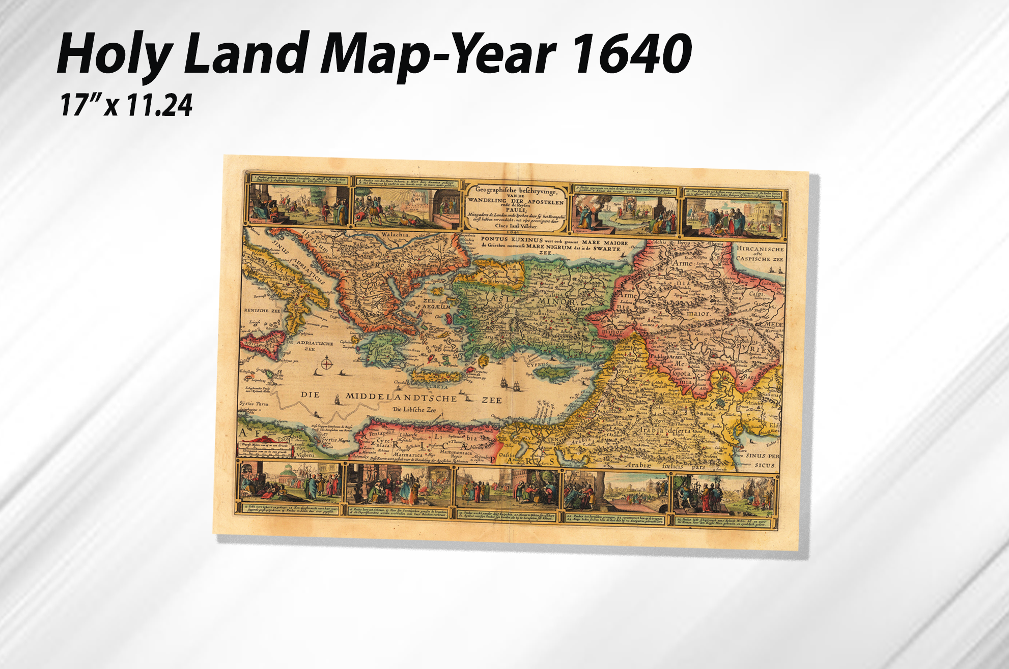
Map- Holy Land in the Year 1642
$6.95
Description
Map – Holy Land in the Year 1642 is a full-color historical map featuring important cities, religious sites, geographical features, and locations throughout the Holy Land.
Printed at 17″ × 11.25″ on premium bright white 100 lb. stock, this detailed map provides an educational look at the history, geography, and religious significance of the region.
It includes information related to:
- Judaism and biblical history
- The Promised Land
- The First Tabernacle through Herod’s Temple
- Historic cities and settlements
- Rivers and bodies of water
- Roads, canals, ruins, and geographic features
A useful resource for Bible study, church classrooms, teaching, and historical reference.
Additional information
| Weight | 2 lbs |
|---|---|
| Dimensions | 18 × 2 × 2 in |
You must be logged in to post a review.


Reviews
There are no reviews yet.